Dunaverty Rock
The site of Dunaverty Castle
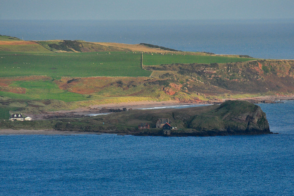
A prominent rocky head land on the south east corner of Kintyre, Scotland.
A brief history
In 712 this stronghold was besieged by Sealbach, King of Dalriada. In 1263 it was captured by King Haakon of Norway and in 1306 Robert the Bruce was sheltered here. In 1558 it was attacked by the Earl of Sussex, but it was in 1647 that the castle saw its final, and bloodiest, act of violence. Royalist forces had been defeated in North Kintyre and had withdrawn to the relative safety of the Castle on Dunaverty Rock, where they were besieged. When they finally surrendered, all 300 were massacred by the Covenanting army of General David Leslie.
Image right: Reconstruction by Andrew Spratt
The 1647 Memorial
This small stone cottage-like memorial enclosure was erected by the Rev. Douglas Macdonald Laird of Sanada in 1846. It houses human remains found close by relating to the massacre of the occupants of Dunaverty Castle in 1647.
It is located at the entrance to the road that leads to the Dunaverty Golf course in a field just to the south of the village of Southend.
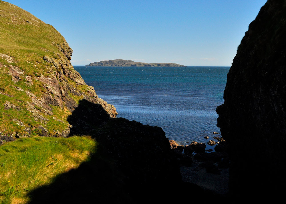
A natural defence
The castle was demolished in the late seventeenth century but the natural rock of the headland upon which it stood was always the primary defensive element of the structure, forming a natural stronghold with the sea on three sides and is only approachable from the north.
It is attached to the mainland only by a narrow path. It is known that the castle itself was accessed by a drawbridge.
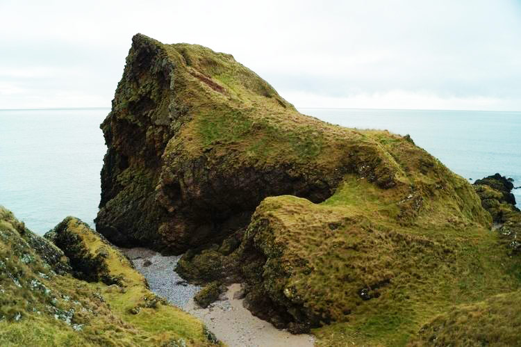
What is there to see?
Today there are no visible remains of the castle, although the site is protected as a scheduled monument.
The site has lost nothing of its dramatic setting over the centuries, and there are good views of the surrounding area.
Access to the site is very steep and dangerous. The ascent of Dunaverty is on a very rough path above steep drops. The track is slippery when wet or boggy at best. There are no guard rails or guide ropes.
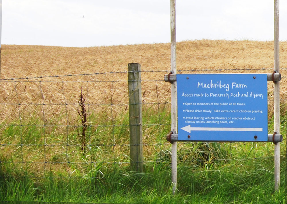
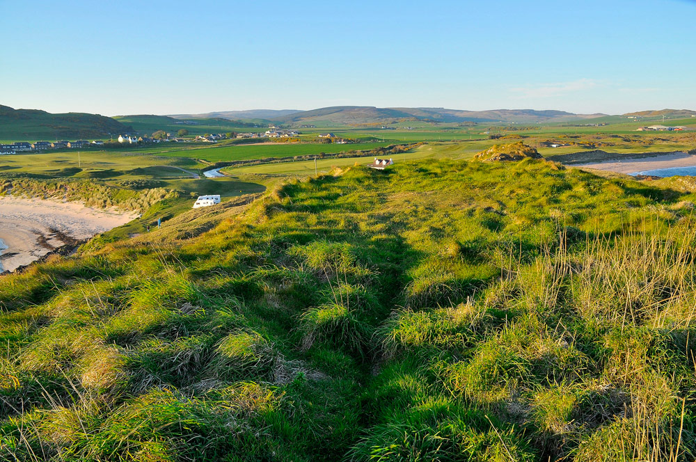
Location
Parking is located at the west side of Dunaverty bay from which you can walk across the beach, or in Southend village from which a footpath crosses the Dunaverty golf club. From the B842 at Southend take the track signposted Dunaverty Golf Club.
A Kintyre Way sign can be found at the end of the track. To the right lies a gate. Beyond the house a small concrete retaining wall crosses the rough path that leads to the gap between Dunaverty Rock and the mainland.
View gallery

Please note:
This information is provided as background information of the history of the site. It is not intended as advice and guidance for visitors to Dunaverty Rock. Self Catering Kintyre cannot be held responsible for the welfare of visitors to the site.